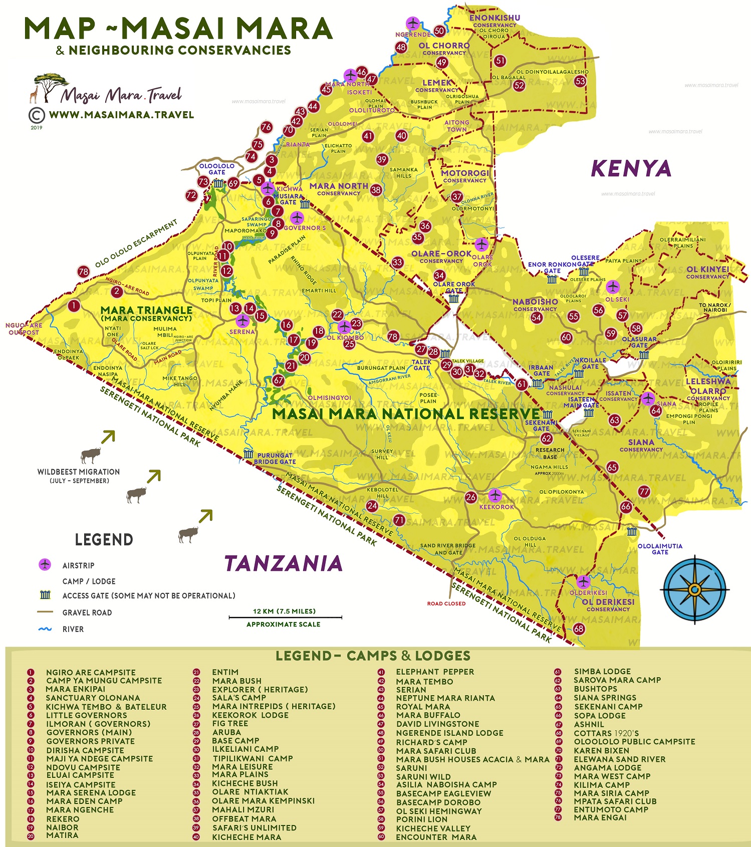
Below is a map of Masai Mara displaying both the main Masai Mara National Reserve as well as a map of the conservancies surrounding the reserve, free to download for tourists. The core park itself is split into an Eastern side (Narok County) and Western side (Trans-Mara county) also known as Mara Conservancy. Other maps are of surrounding Masai Mara Conservancies or group ranches Mara North, Siana, Lemek, Koiyaki, Naboisho, Olare Orok and Ol Kinyei.
The Masai Mara Map below also indicates general position of major accommodation such as permanent Tented Camps, Lodges and selected Campsites. Note that the map is not to accurate scale. Please contact us in case you need exact coodinates or positions. Click here for the Google Maps link
 A privacy reminder from Masai Mara Travel. Our website may use cookies for a more relevant browsing experience.